Flat Earth HD - Satellite Image Viewer 1.1.0
Free Version
Publisher Description
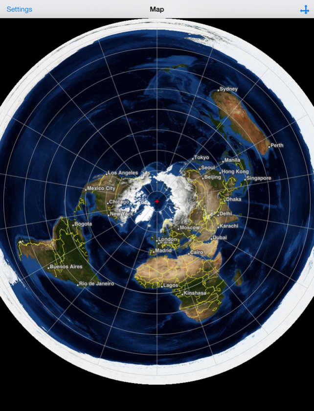
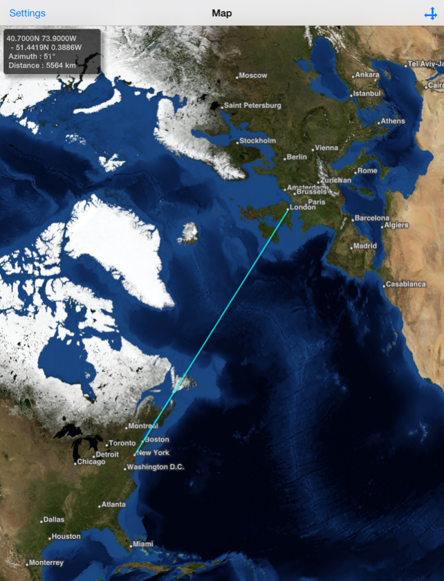
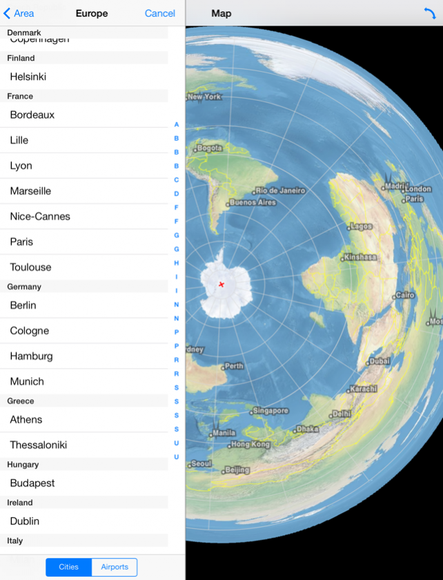

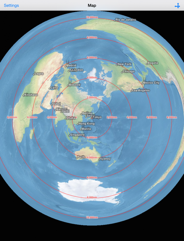
This is an application that displays satellite images of whole earth in Azimuthal Equidistant projection centering on arbitrary points. Directions: Double tap: Move the center of projection. Pan: Translate maps (only in the translation mode). Revolve maps around the center of projection (only in the rotation mode). Pinch: Zoom in or zoom out on maps (only in the translation mode). The button on the right side of the navigation bar: Switch between the translation and the rotation mode. Long Press on the map: Display the shortest path between the center and the long-pressed point. Also, calculate the azimuth clockwise from North and the distance between these points, and show them in a text view. When tap the text view, the text view and the path disappear. Settings view: - Center of projection can be specified in either of the following ways: entering longitude and latitude manually, selecting a city from a list of cities, getting the user's current location. - Select the unit of distance: kilometer (km), mile (mi), nautical mile (nm). - Show/Hide lines of latitude and longitude. - Show/Hide boundaries of countries. - Show/Hide names of major cities. - Show/Hide major airports. (Their names are visible when zooming in.) - Show/Hide concentric circles. - Change images: Blue Marble. Natural Earth. The maximum resolution of satellite images in this current version is 4/480 degrees per pixel. This application can be used in offline environment, but will be more limited in resolution. Credits: Blue Marble: Next Generation was produced by Reto Stockli, NASA Earth Observatory (NASA Goddard Space Flight Center). Natural Earth: Free vector and raster map data @ naturalearthdata.com. Airport data from OurAirports (http://www.ourairports.com/data/).
Apr 2, 2014 Version 1.1.0 - Show concentric circles.
About Flat Earth HD - Satellite Image Viewer
Flat Earth HD - Satellite Image Viewer is a free app for iOS published in the Recreation list of apps, part of Home & Hobby.
The company that develops Flat Earth HD - Satellite Image Viewer is Flat Earth Lab. The latest version released by its developer is 1.1.0.
To install Flat Earth HD - Satellite Image Viewer on your iOS device, just click the green Continue To App button above to start the installation process. The app is listed on our website since 2014-04-02 and was downloaded 15 times. We have already checked if the download link is safe, however for your own protection we recommend that you scan the downloaded app with your antivirus. Your antivirus may detect the Flat Earth HD - Satellite Image Viewer as malware if the download link is broken.
How to install Flat Earth HD - Satellite Image Viewer on your iOS device:
- Click on the Continue To App button on our website. This will redirect you to the App Store.
- Once the Flat Earth HD - Satellite Image Viewer is shown in the iTunes listing of your iOS device, you can start its download and installation. Tap on the GET button to the right of the app to start downloading it.
- If you are not logged-in the iOS appstore app, you'll be prompted for your your Apple ID and/or password.
- After Flat Earth HD - Satellite Image Viewer is downloaded, you'll see an INSTALL button to the right. Tap on it to start the actual installation of the iOS app.
- Once installation is finished you can tap on the OPEN button to start it. Its icon will also be added to your device home screen.
